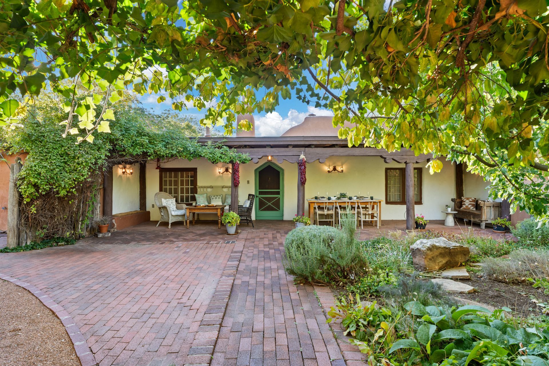
The Boyle House courtyard and historic adobe portal in Santa Fe

THE LOCATION · BARRIO DE ANALCO

Santa Fe,
at your doorstep.

Old streets. Living stories.
A place to begin your own.

Explore the maps ↓
Same streets.
New discoveries.

A SENSE OF PLACE

Find yourself in the story.

The Boyle House sits on East De Vargas Street in Santa Fe’s historic Barrio de Analco, south of the Santa Fe River. From this quiet adobe neighborhood, the Plaza, small museums, galleries, and cafés become part of the rhythm of your stay.

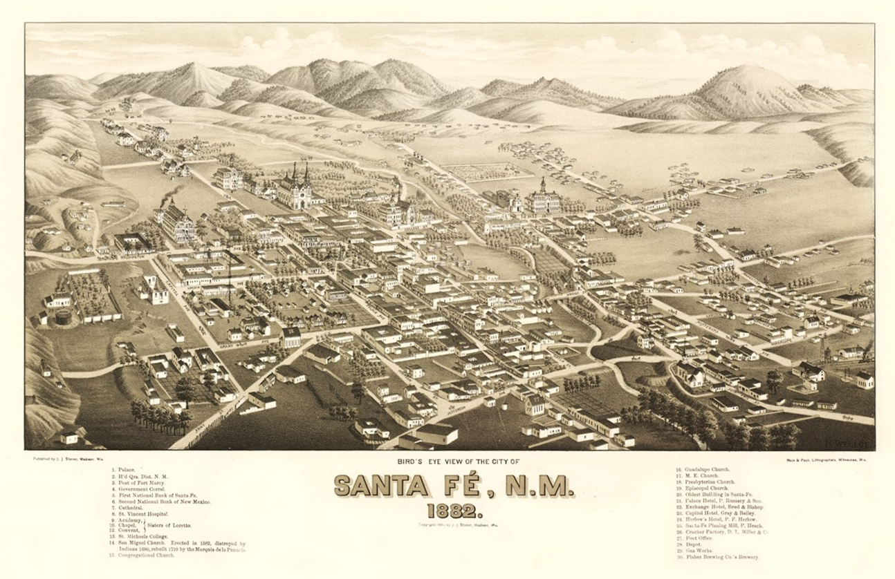
Bird’s-eye map of Santa Fe published in 1882, showing streets, buildings, and the railroad

THEN · 1882

A city taking shape.

Find the Plaza, trace the river, and notice the railroad-era city spreading beyond its older center. This bird’s-eye view is an illustration of its time, rather than a measured street plan.

Explore the Library of Congress record ↗

J. J. Stoner, Bird’s eye view of the city of Santa Fé, N.M., 1882. Public-domain map; image via Wikimedia Commons / New Mexico Archives.

NOW · YOUR SANTA FE STAY

Let the day unfold.

Use today’s map to orient yourself around East De Vargas Street, Old Santa Fe Trail, and the Plaza. The map shows the neighborhood; follow your reservation’s arrival instructions for the correct entrance and parking.

The official downtown visitor map currently offered by TOURISM Santa Fe is dated April 2022. Follow current signs and check routes before traveling.

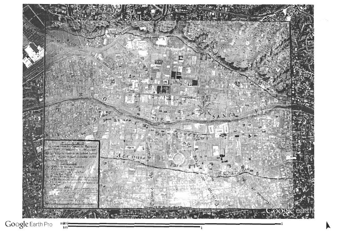
Archival comparison placing Urrutia’s 1766 Santa Fe map over a later Google Earth aerial view
Urrutia map comparison from the owners’ historical records. Historical map: 1766. Date of the later aerial base is not recorded in the supplied document. Google Earth / USGS attribution retained.

1766 · THE OLDER LAYERS

Follow the river through time.

Joseph de Urrutia’s 1766 map records the Plaza, churches, acequias, and the Barrio de Analco. In the owners’ overlay, that early plan meets a later aerial view—a way to notice what endures as the city grows.

This comparison is historical context, not a current navigation or property-boundary map. Indigenous life in this area long predates the colonial maps.

Browse more historic Santa Fe maps ↗

STEP OUTSIDE

A walk through the centuries.

Start on East De Vargas Street, walk west to San Miguel and the Oldest House, then turn north along Old Santa Fe Trail toward Loretto Chapel and the Plaza. Take it slowly; the best details often sit just above a doorway.

Open the suggested walking route ↗
01 · EAST DE VARGAS STREET

Barrio de Analco

Begin with the neighborhood itself. Look for the Historic Santa Fe Foundation plaque near East De Vargas Street and Old Santa Fe Trail. The district’s adobe buildings hold stories of Indigenous residents, Spanish settlement, tradespeople, and family life.

Read the district story ↗
02 · 401 OLD SANTA FE TRAIL

San Miguel Chapel

Step inside this adobe landmark when it is open to visitors. In use before 1626 and rebuilt in 1710 after the Pueblo Revolt, the chapel offers a close encounter with Santa Fe’s layered history. Docents can help you notice the details.

Visitor hours & admission ↗
03 · 215 EAST DE VARGAS STREET

The Oldest House

Just beside San Miguel, this small museum gives another view of life in old Santa Fe. Its familiar name is part of local tradition; the building’s exact age is uncertain. Enter through the adjoining gift shop.

Plan a museum visit ↗
04 · OLD SANTA FE TRAIL

Loretto Chapel

Continue toward the Plaza for a different architectural chapter. Loretto’s Gothic Revival interior and celebrated wooden spiral staircase make an inviting stop. Check visiting arrangements, as the chapel also hosts private events.

Explore Loretto Chapel ↗
05 · THE PLAZA & 113 LINCOLN AVENUE

Palace of the Governors

Pause at the Plaza, then follow the story into the New Mexico History Museum. Access to the Palace of the Governors is through the museum’s main entrance at 113 Lincoln Avenue. Allow extra time for the exhibitions.

Museum tickets & accessibility ↗
06 · EXTEND YOUR AFTERNOON

Canyon Road & beyond

Make room for a gallery visit, a long lunch, or a quiet wander. Canyon Road, the Railyard, and Santa Fe’s museums offer different ways to spend the afternoon. Let the day’s weather, opening hours, and your curiosity set the pace.

Explore Santa Fe neighborhoods ↗

This is a suggested sequence, not a timed or accessibility-assessed tour. Sidewalks, crossings, uneven surfaces, and admission requirements vary. Historic homes along the way remain private; enjoy their street-facing details respectfully.

A LITTLE LOCAL KNOWLEDGE

Arrive easily. Settle in.

Finding the house & parking

Your reservation includes the arrival details for the Main House, Casita, or full property. Use those directions for your entrance and assigned parking. Around downtown, use signed spaces and allow extra time during festivals and busy weekends.

City parking locations & current rates ↗

Getting to Santa Fe

Plan ahead for transfers from Santa Fe Regional Airport or Albuquerque. If traveling by train, check the Rail Runner timetable and onward connections before making plans; service patterns vary by day.

Official transportation guide ↗

Moving at your own pace

Wear comfortable shoes, bring layers, and leave room for a pause in the shade. Historic streets and buildings can have steps and uneven surfaces. Contact attractions about access needs before visiting, and ask our team about the house’s layout before booking.

Ask our local team →

What’s happening while you’re here

Exhibitions, markets, performances, and seasonal celebrations give each visit its own character. Check the current calendar and reserve restaurants or ticketed experiences in advance when possible.

MAKE YOURSELF AT HOME

Come for Santa Fe.
Stay for the stories.

A historic home, a walkable neighborhood, and time to discover what draws you here.

Map credits, historical sources & visitor information

Historical context: Historic Santa Fe Foundation map collection and National Park Service: Barrio de Analco. The 1882 map is reproduced from Wikimedia Commons; the 1766 overlay comes from the owners’ records. Nearby marker location: City of Santa Fe neighborhood guide. Each stop links to its official visitor information. Visitor links reviewed October 2026; hours, admission, transport services, and access can change.